
Alonzo Stagg Hall of Fame
Introduction
The Alonzo Stagg 50/20 Hike (ASH) is a one-day hike through Arlington, Maryland, and Washington, DC. The ultimate goal of the hike is to walk 50-miles in 20 hours; however hikers can chose how far they walk based on their own endurance: 10-, 20-, 25-, and 50-mile options are offered (10-mile minimum). It is a popular event in the Chain Bridge District, with between 150 and 300 hikers participating each year.
The Hike is typically held on the second double-digit Saturday in March. Because of an early Easter and Spring Break, the 2024 ASH will be held on Saturday, March 16th. Due to excessive dropouts (typically 50 percent), the hike is RARELY postponed.
Units interested in participating need to attend the Hike Planning Meeting, usually held in January or February. Registration is individual, through an online signup (typically CheddarUp) but participants must be associated with a participating unit.
EVERYONE participating in the hike (BOTH HIKERS AND STAFFERS) need to complete the online registration including the necessary waivers and permission slips. Online registration closes the Sunday before the hike – this is necessary for permit finalization and food and beverage purchase.
The hike is limited to active members of BSA from participating (supporting) Units. This is to ensure that medical forms are on fill with all individuals hiking.
Troop and Scout Registration
Troops interested in participating need to attend the Hike Planning Meetings to ensure their troop is listed in the online registration when that becomes available.
Preparing for the Alonzo Stagg
All Hikers are personally responsible for being prepared for the ASH 50/20. The following pages provide great advice for all hikers. Be prepared!
- Training Information
- Nutrition and Fluid Suggestions
- Equipment Advice
- Sleep and Attitude
- Cold Weather Hints for Hikers
- Cold Weather Hints for Staffers
- Advice for Hiking in Wet Conditions
Route Information
The hike route offers multiple choices depending on how far a hiker wishes to go: 10, 20, and 25 miles, and 32.5 to 50 miles. The 10 and 20 mile hikes start and end at St. Agnes. The other routes begin at St. Agnes and continue through parts of Maryland, DC, and Arlington. The Route Directions provide detailed turn-by-turn instructions for each hike distance. Each Unit is responsible for providing their hikers with copies of the directions for their respective hikes and a copy of the Trail Rules and Emergency Procedures Guide. THESE SHEETS SHOULD BE ENCLOSED IN A ZIP-LOCK BAG AND CARRIED BY THE HIKER FOR HIS ENTIRE HIKE!
- 10- and 20-mile Route Directions
- 25- and 50-mile Route Directions
- Trail Rules and Emergency Procedures Guide (2024)
- Morning of Hike Primer (2024)
Staffing and Setup Information
- Staff Position Descriptions
- Support Stop Schematic
- Support Stop Set-up and Operations
- Waypoint Operations
- Tail-End Charlies Operations
- Bikers Operations
- Bluemont Hiker Escorts Operations
Maps for Alonzo Stagg 50/20 Hikers – All distances
- 10 Mile Hike Route (Useful for 10 Mile Hikers)
- 20 Mile Hike Route (Useful for 20 Mile Hikers)
- St. Agnes to Great Falls (Useful for 25 to 50 Mile Hikers)
- Key Bridge to Gravelly to Bluemont (Useful for Hikers Doing 32 to 50 Miles)
- Bluemont Loops (Useful for 50 Mile Hikers)
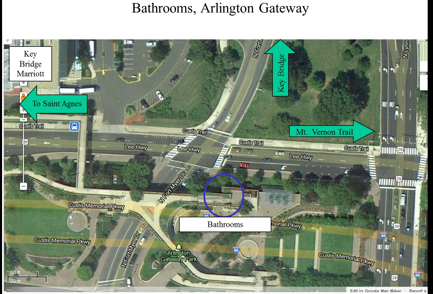
- Bathrooms at Key Bridge Arlington Gateway (Useful for Hikers and Waypoint Personnel at the Lee Highway Waypoint)
- Hiker Help Expansion Map – Military Road to Chain Bridge (All Hikers)
- Hiker Help Expansion Map – Mt. Vernon Trail to Four Mile Run Trail (50 Mile Hikers)
- Hiker Help Expansion Map – Shirlington Bypass on the Four Mile Run Trail, and the Shift to the W&OD Trail at Shirlington Road (50 Mile Hikers)
Driving Directions and Maps for Support Stations for Staffers, Shuttle Drivers, and for Parents Picking Up Scouts Who Are Dropping Out
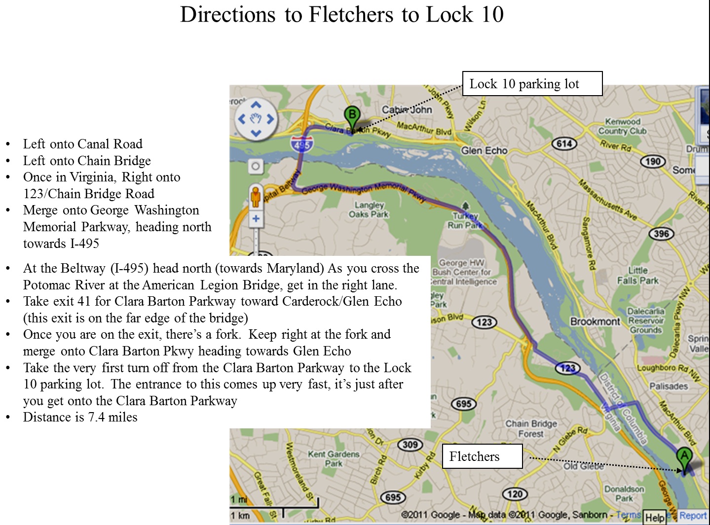
- Fletchers to Lock 10 (for Shuttle Drivers Returning to Lock 10) (FOR DRIVERS NOT HIKERS!)
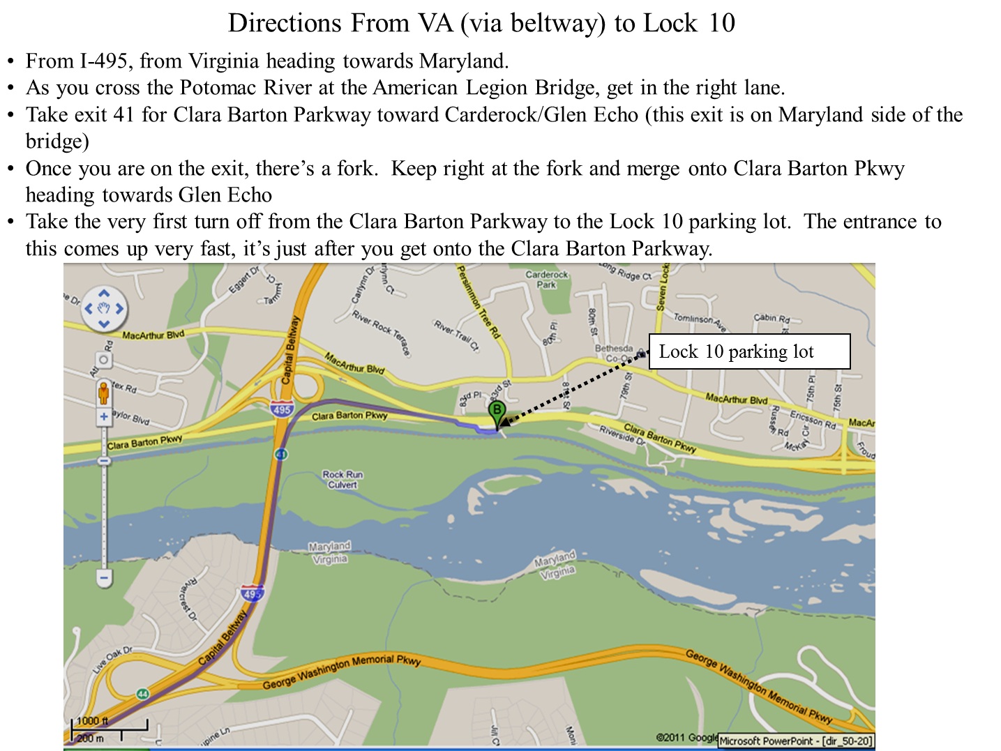
- Directions to Lock 10 from St. Agnes (FOR DRIVERS NOT HIKERS!)
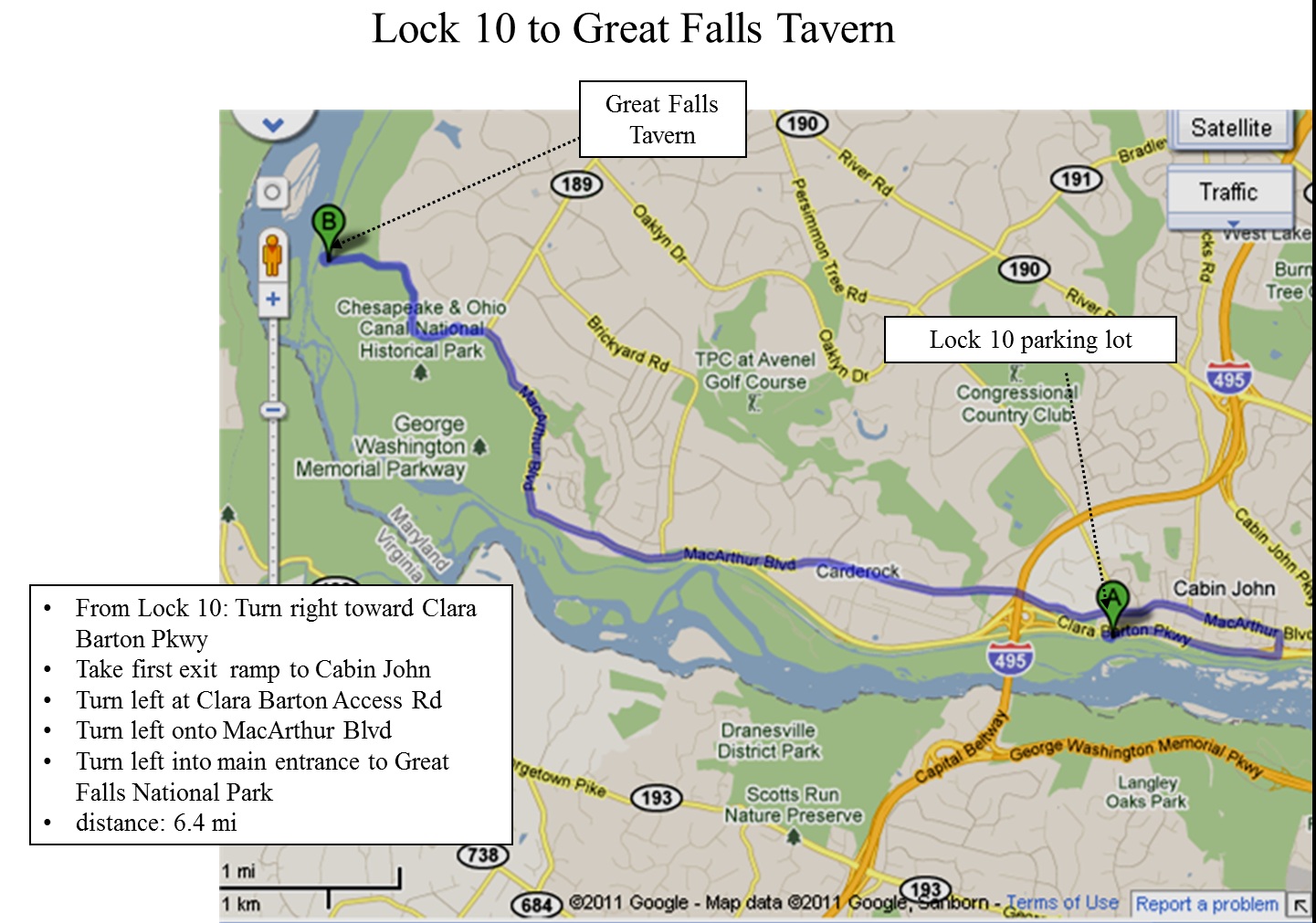
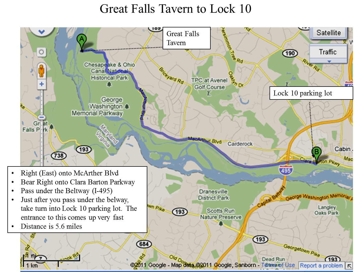
- Lock 10 to Great Falls (FOR DRIVERS NOT HIKERS!)
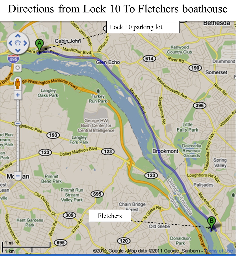
- Lock 10 to Fletchers (FOR DRIVERS NOT HIKERS!)
- Great Falls to Lock 10 (FOR DRIVERS NOT HIKERS!)
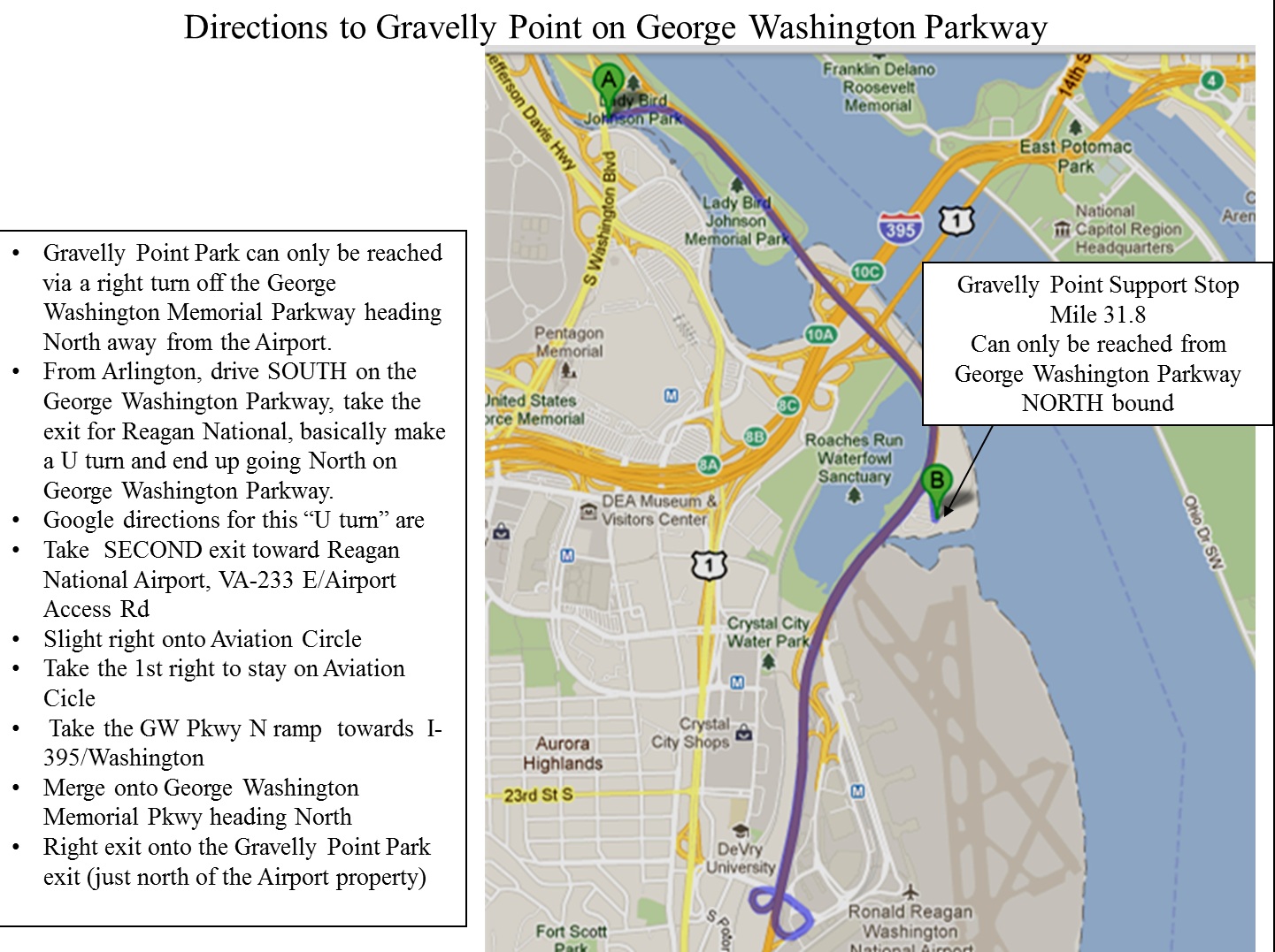
- Directions to Gravelly Point (FOR DRIVERS NOT HIKERS!)
- Directions to Great Falls from St. Agnes (FOR DRIVERS NOT HIKERS!)
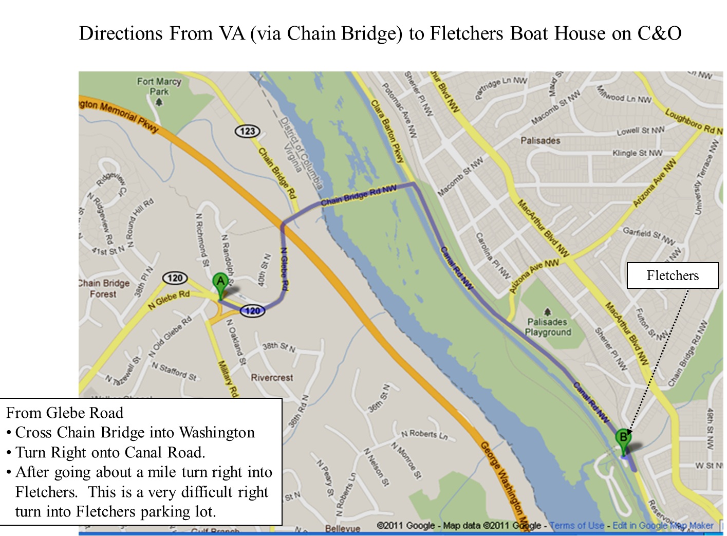
- Directions to Fletchers from St. Agnes (FOR DRIVERS NOT HIKERS!)
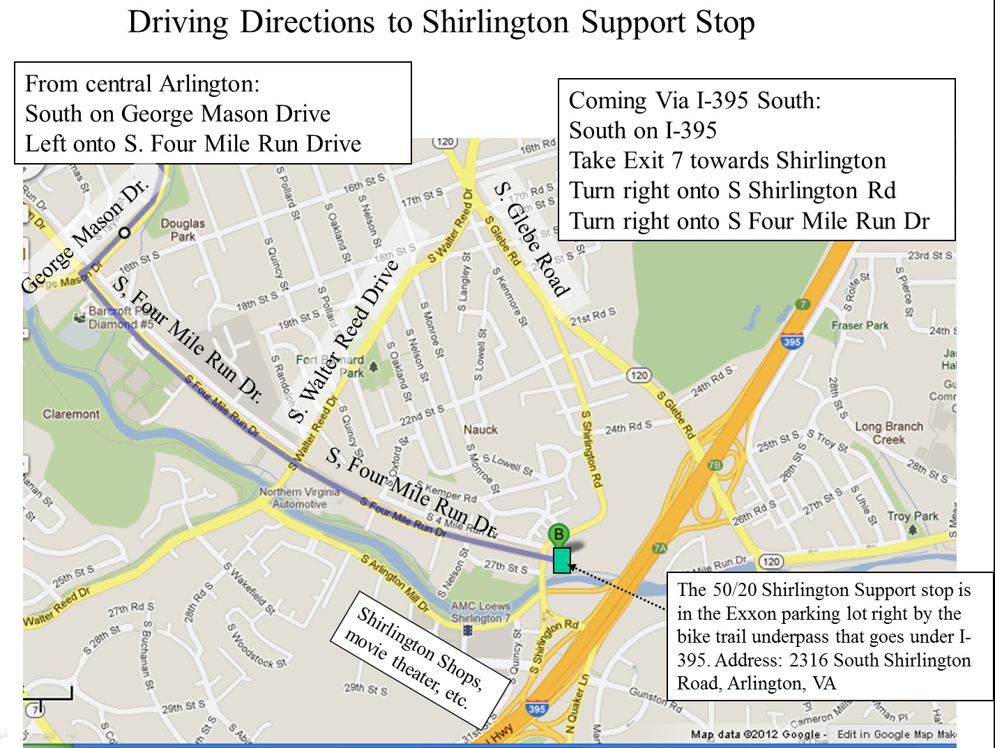
- Shirlington Support Stop (FOR DRIVERS NOT HIKERS!)
